


GE-Graph: Graph for GoogleEarth
[Home] [Ge-Path] [KML Color converter] [Scale 2.0] [Climogram]
|
[Browse questions & answers/comments/suggestions/bug reports] [GE-Path/Graph in the Web]
|
|
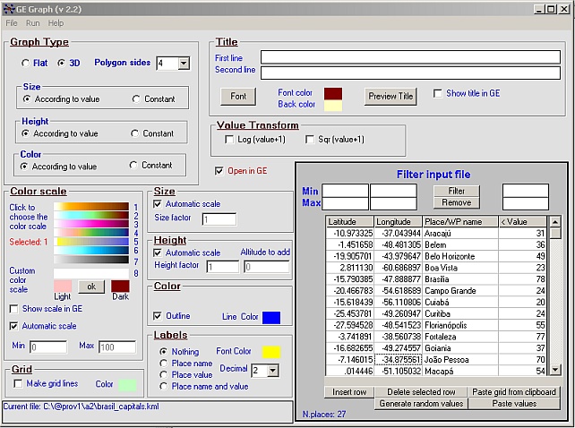
Make graph into GE to illustrate your presentations, papers, etc. Good tool for Geography educators Freeware v 2.2.21
GE-Graph was developed to generate
graphs from kml files saved by Google Earth.
|
Download the full installer of GE-Graph
2.2.21(2287 k) - v. 2.2.21
(unzip the file in a temporary folder and run setup.exe)
If the
installer fails to register the ecGrid.ocx control, please register it with
Register Dll Tool
PayPal
-
If you have already installed a previous version you can download only the updated executable file
-
Unpack it in the application directory and update your shortcuts.
Download updated executable (104 k) (v 2.2.21)
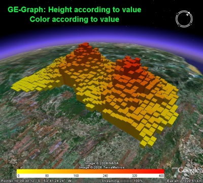
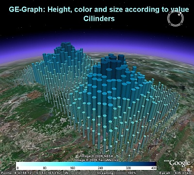
Screen shot
Click in the images to download the corresponding .kmz file Original files used
to draw the graphics (you have to generate random values for fig D, E, F
and G): Figures A & B epidemics.zip
txt- 13k; Figures C & D brazil_borders.zip kml 88k (from bbs
keyhole - Valery35); Figures E, F & G brazil_capital.zip kml-
2k (Download State/province borders of 144 countries,
for choropleth maps as Figures C and D)
|
||
 |
 | |
C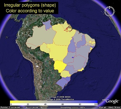 |
D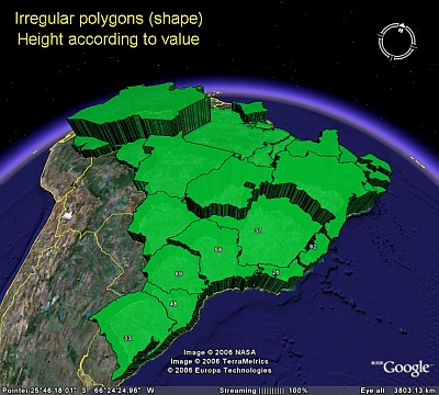 | |
E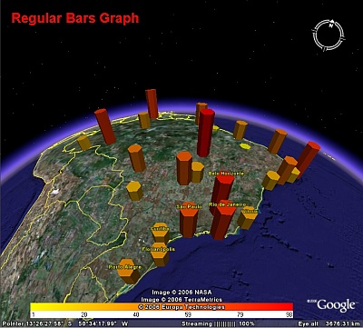 |
F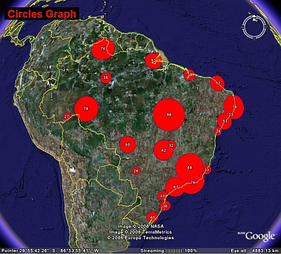 | |
G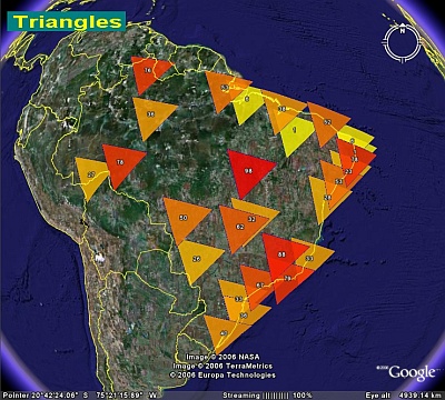 |
H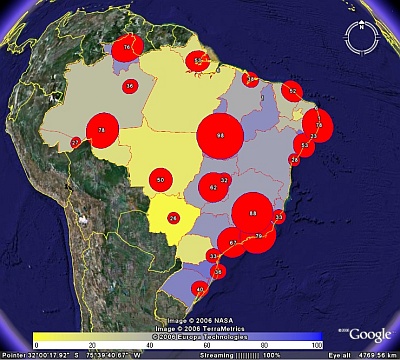 | |
Here there are polygon txt files of 144 country's states/provinces border. The text files were generated by GE-Grah, after fixing the polygon coordinates sequence order. The original kml files were published by Valery35 in the bbs keyhole forum (Education/Tools), where you can find more kml files
World Country
borders (207 k)
France province borders (882 k)
Germany
province borders (583 k)
Italy province borders (704 k)
Brasil state
borders (77 k)
USA state borders (924 k)
England (1375 k)
Download state/province borders of 144 countries state_borders.zip (2260 k)
Please report bugs / comment / suggest
The bug in the installer of the application is fixed in this version (2.2.2a) thanks to the contribution of John Davies
R.Sgrillo
Cocoa Research Center
(CEPLAC/CEPEC)
Ilheus, Bahia
Brasil